Tuesday, October 11, 2016

October 11, 2016

SanPedroRiparianNCA.jpg (2500×1666)

What does it mean when the water is on both sides of the border?  Work at your table to work through the article from High Country News.

group-people-hold-cubes-text-review-action-metaphor-separated-white-40926972.jpg (284×160)

Quiz Tomorrow!  What are boundaries?  How are they defined?  What disputes can there be?  Who maintains and controls borders?


Monday, October 10, 2016

Political Geography Vocabulary

Monday, October 10th

political-geography-online-16-728.jpg (728×546)

Finish Presentations

slide_2.jpg (960×720)

"SSSSShhhh, Be Very, Very Quiet"  Work with your groups to view the pictures and define the vocabulary words.  Fill out your graphic organizer!

international.jpg (216×150)

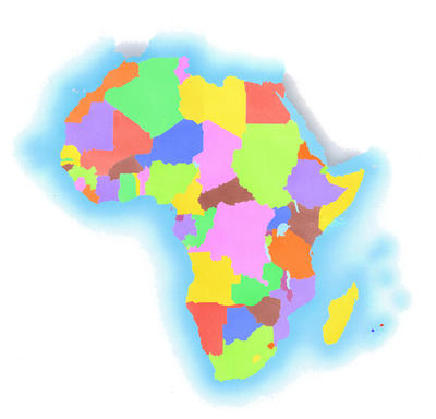
Exit Ticket:  In your journals, write a paragraph describing your process in making the Africa Maps.  Was this an easy thing to do?  Why or why not?  Was it easy making decisions as a group?  How did you decide which information was the most important?  Were you happy with how your map turned out?  This should be at least five sentences long.

Thursday, October 6, 2016

Thursday - October 6, 2016
maxresdefault.jpg (2291×1288)

How Many Countries Are There?

What are the "places" they talk about in the video?  The "places" are ______________________.

Who has veto power in the United Nations?  _________, _______, ________, ________ and ________ have veto power.

How would you define autonomous?  Autonomous is ________.

What is the difference between the UN and the Olympics (in regard to recognizing countries)?  The difference between them is ____.

What makes a country a country?  Why?  What make a country a country is _______________ because ___________.

qa2c05f53.jpg (400×384)

AFRICA PROJECT!!!  The final project is due tomorrow!  This includes the map, your written summary and your presentation.  All items should be shared with Vozick and Ingram.  If you do not finish in class you will need to finish somewhere else by tomorrow.

Wednesday, October 5, 2016

Wednesday - October 5, 2015
hurricane-matthew-track-sunday-oct-2jpg-d15d406e32aa2224.jpg (895×658)10_3_16_Andrea_WX_HurricaneMatthew.jpg (1000×563)
https://www.wunderground.com/wundermap/?lat=21.5&lon=-74.9&hur=1&sat=1

https://weather.com/storms/hurricane/video/matthew-begins-trek-across-bahamas-toward-us?pl=pl-editor-picks

How do large storms impact geography?  Large storms impact geography by ________________________.

What of the 5 themes can you see in the story about Matthew?  The 5 themes I see are _________________________.

What are the political factors that have or may arise from Hurricane Matthew?  The political factors are __________________.

Africa_(satellite_image).jpg (5723×5563)

Group Time:  Some other questions to consider:

How do the 5 Themes of Geography play a role in your decisions?  Which themes are you including?

Are there any disease outbreaks or health concerns that would be best to keep together?

Were there any old wars/battles that were caused by how the map was put together?

Check in on time- where are you in the project, do you need to do anything at home!

Sunday, October 2, 2016

Tuesday - October 4, 2016
1443695087-0.jpg (600×337)
https://www.good.is/slideshows/interesting-borders#0

What was one border that showed cooperation?  How so?   One border showing cooperation was ______________ because _____________.

What was one border showing conflict?  Why?  One border with conflict was ______________ because ______________.

What was a surprising border to look at?  Why?  A surprising border was __________________ because ______________.
Image result for africa


AFRICA PROJECT CONTINUES


Don't forget the 3 D's: Define the borders, delimit the borders and demarcate the borders.  

Who is going to administer your borders? 

What are the primary natural resources to be found in Africa?  Where are they located?

What physical features might impact your decisions?

What cultural regions are important to maintain?

Are any decisions from the Berlin Conference worth maintaining? 


Image result for exit ticket

On a post-it, write any questions about project?

My question is _______________________.

Also tell us how your group is working together. Explain.

My group is doing ____________because ______________.


Monday - October 3, 2016

4815c667ba3ab9319118b83ecd537e86.jpg (564×431)

What is this cartoon telling us about political geography?  This cartoon is telling us _________.

Where are the geographic locations or cultural groups referenced in the cartoons?  1780 ________; 1850 _________; 1920 _________________; Now ______________.

guardianmap-africa1900.jpg (800×575)

Re-Mapping Africa:  Creating non-Colonial Boundaries

ticket-clipart-and-illustrations-n1EsWU-clipart.jpg (167×170)

What was one thing you were surprised to learn about how Africa was divided by European countries?  I was surprised to learn ______________________________.

What are the one or two factors you are most likely to include in your new map of Africa? Why?  We are likely to include _________________ because ______________________.